History of Richmond
Aborigines and the Coal Valley
The valley was part of the territory of the Oyster Bay/Big River or Merrimeneer people. They were the largest of the Island’s nations and occupied much of central Tasmania from the Central Plateau to the east coast. The valley was a particularly benign environment for hunter-gatherers. The enfolding hills gave shelter from the more rigorous climate of the highlands. Repeated firing of the vegetation kept the grasslands clear of entangling undergrowth facilitating hunting for the abundant wallabies, emu and wombat. The land near the future site of Richmond was doubly valuable. It was the most southerly point where it was easy to ford the river on journeys to and from the east coast. The river provided water birds and a permanent supply of fresh water even in the driest summer. It was probably the site of semi-permanent summer camps from where hunting expeditions ranged across the nearby hills. The confrontation on the other side of Grass Tree Hill at Risdon Cove in April 1804 between a large hunting party and the British settlers indicated the ability of the local grasslands to support large gatherings which may have been located near the Coal River.
The settlers arrive
Land that was good for the Aborigines was good for the settlers. Being close to the two original settlements at Risdon in 1803 and at Sullivan’s Cove in 1804 the Valley was visited by official exploring expedition and small private parties. Its economic potential was quickly appreciated. A coal seam by the river bank promised more than it ever delivered. But there was abundant sandstone on the nearby hills and clay for brick making on the Valley floor. The sandstone could be delivered into the village with the help of gravity. A limestone deposit was found farther up the valley.
The Aborigines had created productive hunting grounds. The settlers quickly took advantage of them for their own hunting expeditions. The hills between the Derwent and the Coal became the most popular hunting grounds in the early years of the colony. The gentlemen and military officers rode out of town to Risdon and took the punt over the river. At his estate of Restdown on the eastern shore T.G. Gregson kept the best pack of hounds in the colony. The hunters ranged across the hills and returned for refreshment to inns in Richmond or at Kangaroo point as Bellerive was originally called.
Pioneer Farming
Aboriginal land management had created rolling grassland ready for the plough. It was very different from the heavily forested hills around Hobart. The soils were among the best discovered in Australia up to that time. It compared favourably with the farmland along the Hawkesbury River in New South Wales which suffered from frequent disastrous flooding. The climate was far more suitable for growing wheat than anywhere in coastal New South Wales with its drenching summer rains. The Valley, the nearby fields running down to Pitt Water and the land around Rokeby known as the Clarence Plains became the most important and productive grain growing areas in early Australia. They have an important place in the history of Australian agriculture. There was the additional advantage of the ease with which the pioneer farmers could transport their wheat to ships which were able to sail up to the edge of the town. Access to Pitt water was closed off later in the C19th by siltation and the building of the Sorell Causeway in 1872. Wheat from the district became one of the fledgling colony’s major exports. Ships carried large cargoes from the valley to Sydney and returned with red cedar which found a ready market for house building in the Island.
Communications
The Bridge has played an important part in Richmond’s history since its construction. It was built to provide a crucial link in the land communications of the young colony providing all season transit between Hobart and the east coast. It became more important with the establishment of the major penal settlement at Port Arthur. The site was not chosen by chance. To be successful there needed to be a point where the river valley was at its narrowest and where the banks were high and stable enough to allow successful construction. The ready availability of sandstone on nearby Butcher’s Hill added to the attractions of the site. But the greatest advantage for the settlers as for the Aborigines before them was that Richmond was the most southerly point that allowed for a short and easy route across the complex and progressively wider waterways to the east of Hobart.
The Convict System
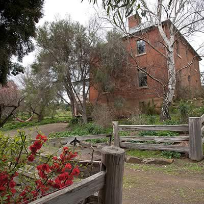
The early history of Richmond was closely bound up with the system which had many ramifications. It necessitated strong, active and authoritarian government. Richmond was an obvious location for administrative machinery. It required a courthouse, a resident magistrate, a prison and barracks for the detachment of soldiers who acted as guards. Large gangs of convict labourers and military engineers made large public works projects like the bridge achievable. Because of the system the government felt it necessary to subsidize the building of churches and schools on a scale much more impressive than was possible for small rural communities after the end of transportation. The provision of convict servants to the free settlers under the assignment system allowed the local gentry and the town’s professional and commercial leaders to build impressive houses, stables, barns, shops and hotels which survive to the present day.
The colonial town was built in a few years. It did not grow slowly like villages in the old world. Having made the decision to create a town the site was surveyed, the streets laid down in a grid pattern, running east-west and north-south. The high cost of transport meant that the whole town was made from local materials…sandstone from the hill, bricks made on the spot from local clay. The lack of trees meant that there were few timber houses. Because the town was a creation of a few years in the 1820s and 1830s it is dominated by the Georgian architecture which had been fashionable in Great Britain at the time and which had provided the professional background for local builders and tradesmen. The two churches St. Luke’s and particularly St. John’s show the early intrusion of what in Britain was called the gothic revival.
Having prospered in the convict era Richmond stagnated until well into the C20th. The good farming land was locked up in large estates granted in the 1820s. Little new land was available. Young people moved away to Victoria or to the new farming and mining districts in the north of the colony. The fertility of local soils declined and yields dropped. The building of the Sorell causeway in the 1870s and a railway in the 1880s took most of Richmond’s traffic away. The north-south rail line crossed the Derwent at Bridgewater and then swung east to Campania avoiding the hills which surrounded Richmond. As a result much of the early colonial town survived into the C20th and an era when heritage was progressively more valued. But unlike colonial towns elsewhere a few major buildings survived the boom conditions of mid and late C19th Australia Richmond contains the full range of buildings…the large mansions on the outskirts, pubs and shops, town houses built for the well to do business and professional families and tiny Georgian cottages which houses the urban labourers and tradesmen. It all means that by the chance of both history and geography Richmond today provides a more comprehensive picture of life in the first half of the C19th than any other town in the country.
by Henry Reynolds